| dcterms.abstract | Im Rahmen der Fallstudie Harz sollte an der Schnittstelle zwischen Grundlagenforschung und angewandter Forschung ein Beitrag zur Klärung der Frage geleistet werden, inwieweit zwei Zuläufe der Sösetalsperre im Westharz versauert bzw. versauerungsgefährdet sind; aus diesem Stausee wird Trinkwasser für mehrere Gemeinden in Norddeutschland gewonnen.
Die Belastung des fast vollständig bewaldeten Einzugsgebiets der Sösetalsperre mit luftbürtigen Schadstoffen (Saurer Regen) zählte zu den höchsten in Mitteleuropa.
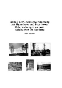
An jeweils drei Untersuchungsstellen der beiden Bäche Alte Riefensbeek (R1 bis R3) und Große Söse (S1 bis S3) wurden zwischen März 1987 und November 1988 Proben aus Moospolstern und dem hyporheischen Interstitial entnommen und physikalisch, chemisch und biologisch untersucht. Ergänzend wurden Wasserproben zwischen März 1986 und Oktober 1991 sowie vom April 1998 ebenso wie qualitative Fänge von Makroinvertebraten zwischen November 1986 und Juli 1990 sowie vom April 1998 ausgewertet. Die Analyse der tierischen Besiedlung der Moos- und Interstitialproben beschränkte sich auf die taxonomischen Gruppen Turbellaria (Strudelwürmer), Mollusca (Weichtiere), Amphipoda (Flohkrebse), Ephemeroptera (Eintagsfliegen), Plecoptera (Steinfliegen), Heteroptera (Wanzen), Megaloptera (Schlammfliegen), Coleoptera (Käfer), Trichoptera (Köcherfliegen) und Diptera (Zweiflügler).
Der Grundsatz, daß normalverteilte und nicht normalverteilte Daten statistisch unterschiedlich behandelt werden müssen, wurde konsequent angewandt.
Am Beispiel der Choriotopstruktur wurde gezeigt, daß die Auswahl des Analyseverfahrens das Ergebnis der ökologischen Interpretation multivariater statistischer Auswertung beeinflußt. Die Daten der Korngrößen-Verteilung wurden vergleichend einer univariaten und einer multivariaten statistischen Analyse unterworfen. Mit dem univariaten Verfahren wurden die Gradienten der ökologisch relevanten Korngrößen-Parameter eher erkannt als mit dem multivariaten Verfahren.
Die Auswirkungen von Gewässerversauerung sowie anderer Umweltfaktoren (insgesamt 42 Faktoren) auf die Lebensgemeinschaften wurden anhand der Parameter Artenzahl, Besiedlungsdichte, Körpergröße und Biomasse untersucht.
Abundanz, Biomasse und Körpergröße sowie die Umweltfaktoren wurden auf einem horizontalen Gradienten, d.h. im Längslauf der Bäche, und auf einem vertikalen Gradienten, d.h. fließende Welle / Bryorheon / Benthon versus Hyporheon, untersucht.
Es wurde ein terminologisches System für die Kompartimente in der Fließgewässer-Aue vorgeschlagen, das in sich einheitlich ist. Es wurde ein neuer Moos-Vitalitätsindex für die Moospolster vorgestellt. Es wurden Bestimmungsschlüssel für die Larven der Chloroperlidae (Steinfliegen-Familie) und der Empididae (Tanzfliegen) in den beiden Harzbächen entwickelt. Die untersuchten Bachstrecken waren frei von Abwasserbelastung. An zwei Stellen wurde Wasser für einen Forellenteich ausgeleitet. Abgesehen von zwei meterhohen Abstürzen in der Großen Söse waren wasserbauliche Veränderungen ohne große Bedeutung. Das Abfluß-Regime war insofern nicht mehr natürlich, als beide Bäche in das System der bergbaulichen Bewässerungsgräben des Oberharzes eingebunden sind. | ger |
| dcterms.abstract | As a part of the `case study Harz'
this project aimed at answering the
question at the interface between basic and applied research as to what degree
two triburaries of the Söse Reservoir (western Harz Mountains) are acidified or
prone to acidification.
Drinking water for several municipalities spread over North Germany is gained
from this reservoir.
The catchment of the Söse Reservoir which is nearly completely forested
was stressed by pollutants from the air
(`acid' rain) to an amount ranking
as one of the highest in Central Europe.
Samples from moss clumps and the hyporheic zone were taken between
March 1987 and November 1988 at three stations each on the brooks
Alte Riefensbeek (R1 to R3) and Große Söse (S1 to S3)
and examined by physical, chemical and biological means.
Additionally, water samples between March 1986 and October
as well as from April 1998 were analysed.
Moreover, qualitative catches of
macroinvertebrates between November 1986 and July 1990 as well as from April 1998
were determined.
The examination of invertebrates in the samples of moss clumps
and of the hyporheos was restricted to
Turbellaria (flatworms), Mollusca (snails, mussels), Amphipoda (shrimps),
Ephemeroptera
(mayflies), Plecoptera (stoneflies), Heteroptera (water bugs),
Megaloptera (alder flies),
Coleoptera (beetles),
Trichoptera (caddis flies) und Diptera (midges and flies).
The rule of treating data normally distributed by other methods than
those not normally distributed was applied strictly.
It was shown by the example of choriotope structure
that the method chosen for data analysis influences the result of
ecological interpretation of multivariate data sets.
Data of grain-size distribution were statistically analysed by univariate
and multivariate methods.
The gradients of grain-size parameters being ecologically relevant
were detected better by the univariate method than by the multivariate
method.
The effects of acidification and other environmental factors
(totally 42 factors) on biocoenoses were examined by the parameters
number of species, abundance, body size and biomass.
Abundance, biomass and body size as well as the environmental factors
were studied along a horizontal gradient, i.e. longitudinally along the
brooks, and along a vertical gradient, i.e. surface water / bryorheon / benthon
versus hyporheon.
A consistent terminology for the compartments of the floodplain was
proposed.
A new moss vitality index was introduced.
Keys for the larvae of Chloroperlidae (a family of stoneflies) and
of Empididae (dance flies)
from the Harz brooks examined were developed.
The studied sections of the brooks were free of sewage.
Water for trout ponds was abstracted at two points.
Hydraulic engineering measures
were of minor importance except two fall structures on the
Große Söse brook being higher than 1 m.
The discharge regime was not a natural one because both brooks has become
a part of the irrigation and drainage canals
of the former mines of the Upper Harz Mountains.
The Söse brook had a F-nivopluvial discharge regime with March / April
being the bi-monthly peak of discharge.
The contingency
of the discharge regime was high,
the predictability was very low,
monthly maxima of discharge had a very low constancy.
The period of biological sampling was marked
by an exceptional high number of days with a discharge above average,
but large spates were absent.
The dynamics of discharge were described by statistical means.
The hydraulic regime was described by velocity, stream power
and the FROUDE number.
Relations between grain size distribution and
discharge and velocity, resp.
were analysed statistically
as well as the relation between discharge and the carbon and nitrogen contents
of fine particles and water chemistry.
The hyporheic zone functioned as a sink for fine particles during episodes without
spates.
Sediments of the Alte Riefensbeek brook were more stabler than those of
the Große Söse brook.
In conclusion, the hyporheic sediments were coarser in
headwater sections and finer in downstream stretches.
However, the proportion of fine sediments in the hyporheic and benthic zone
decreased longitudinally.
This is unusual but could not plausiblely be explained by geological and
hydrological parameters.
Both brooks were summer-cool.
The influence of water temperature in biota was analysed with Baetis spp. and
Leuctra gr. inermis as an example.
Overall, the contents of carbon and nitrogen of fine particles increased from
the benthic to the hyporheic zone.
This was further evidence for the hyporheic zone functioning as a sink and storage
compartment for nutrients.
The relation between the particulate and the solute fraction of carbon was
discussed.
Nitrification in the hyporheic zone was not higher than in surface water.
Evidently, the acid water of the Große Söse brook inhibited nitrification.
Valencies of moss and animal species for velocity, pH, alkalinity, oxygen,
calcium, magnesium, potassium and sodium were compiled.
Hyporheic sediments were very coarse and had a high porosity.
Therefore, exchange between surface and hyporheic water was very quick.
An intergranular interface did not exist.
Most of the vertical gradients of physical and chemical parameters
were not or very weakly pronounced.
Temperature of surface water did not differ from hyporheic temperature
significantly.
There were no significant differences between concentrations of surface
and hyporheic water except a few comparisons for pH, conductivity and oxygen.
Therefore, physical and chemical conditions for a
refugial function
of the hyporheic zone for taxa being sensitive for acidification did not exist.
The vertical distribution of abundance and biomass, resp. of the taxa
peaked more often at a depth of 10 cm than at 30 cm.
However, this was not seen as a general rule.
The definition of acidification, namely being characterized as a loss of
buffer capacity, was strictly applied. Acid water can be acidified but this
does not apply in every case.
Acidified water can be acid but this is not applicable in every case either.
Criterion
for the buffer capacity of a water body is not the pH but are
alkalinity and other chemical parameters. pH could not even be employed as
an indicator of acidification operationally.
Due to acidification, chemical water quality of the Große Söse brook did not
meet environmental regulations for pH, aluminium, iron and manganese and for zinc
at station S1, resp.
The hyporheic water from a depth of 30 cm at station R2 on
the Alte Riefensbeek brook did not
satisfy
environmental standards for oxygen.
Ammonia concentration at every station except in surface water at R1 was
higher than the standard of the Fisheries Water Directive of the EEC.
BOD in samples from every depth at R2, from surface water at R3 and S1
and from 30 cm at R3 did not meet the European standards of
the quality of fresh waters needing protection or improvement
in order to support fish life.
The limit value for total phosphorus was exceeded at S3.
Aluminium concentrations of the Große Söse brook were so high that inorganic
and organic fractions could be separated.
Peak amounts
of inorganic aluminium which is toxic were measured on days
with peak discharge and acidification pulses.
Only the calculation of several chemical parameters of acidification
showed that the alkaline water at stations R2 and R3 was at least
sensitive to acidification.
At the beginning of this study, these sections of the Alte Riefensbeek brook
were supposed to be not acidified.
Measurement and calculation of chemical parameters of acidification
should be routineously determined during studies of aquatic acidification.
The approach of the study, namely to compare a non-acidified brook
(Alte Riefensbeek) and an acidified brook (Große Söse),
had to be modified after the calculation of chemical indicators of acidification
and after the analysis of abundance and biomass values.
Instead of this hypothesis,
stations were sorted on an gradient of
acidification:
R1 (non-acidified) R2 and R3
(sensitive to acidification or episodically acidified)
S2 and S3 (permanently acidified) S1
(permanently strongly acidified).
Therefore, the status of acidification at R2 and R3 was more severe than
foreseen.
The hydrogen carbonate buffer system failed permanently at S1
and temporarily at S2 and S3.
Differences of the level of acidification between stations were not
so much caused by different levels of deposition rates of acidifying
substances from the air but were due to different types of base rock with
different buffer capacity.
The contribution of different acid anions to acidification was examined.
Chemical mechanisms of acidification were analysed by ion balances and
several quotients of acidification.
Both brooks were affected by anthropogenic acidification.
Deposition of sulfur (sulfate) played a larger role in this process than
deposition of nitrogen (nitrate).
Station S1 has always been naturally acid to an unknown degree.
This naturally acid condition was far more exceeded by anthropogenic
acidification.
The small amount of limnological data collected
before 1986 for the Söse catchment
points to the manifestation
of acidification from the base rock and soil to the
brooks in the 70th and the first half of the 80th.
The process of acidification started probably before 1973 in the springs
on the Acker-Bruchberg Range and moved down to the valley to the drinking water
reservoir during the following years.
The lack of historical basic field data was a problem not only in the
study area but is generally an obstacle in acidification research.
If the presence of closely related species is vicarious
this will be able to be due to acidification.
For instance, the Alte Riefensbeek brook
was a Gammarus brook, the Große Söse brook was a Niphargus brook.
Such a phenomenon does not have to be caused by acidification in every case,
e.g. Habroleptoides confusa was absent in the hyporheos at R3
while Habrophlebia lauta had its maximum of abundance and biomass at R3.
This was accompanied by the maximum of the proportion of coarse sand at R3
which is a possible reason for this interspecific competition.
Biological indication of acidification by acidity classes
did not work for
both brooks.
Therefore, a biological index of acidification was proposed
not being calibrated against pH but against the chemical degree of
acidification which is defined by alkalinity and other chemical
parameters of acidification.
Abundant taxa were grouped into four classes on the base of quantitative
and qualitative data: strongly sensitive to
acidification, moderately sensitive to acidification, moderately tolerant to
acidification and strongly tolerant to acidification.
It is not sufficient to estimate biological effects of aquatic acidification,
of changes in the availability of food and of further
chemical parameters simply by the number of taxa.
However, quantitative methods, as the determination of abundance values,
have to be employed
in order to detect anthropogenic and natural `disturbance'
of the ecosystem.
A strategy for the official
surveillance of biological water quality of headwaters was proposed
which can identify the risk
of acidification area-widely.
The effects of the temporal dynamic of chemical acidification was
demonstrated by Baetis which is sensitive to acidification.
Strong pulses of acidification occurred at S2 and S3.
Baetis could not survive all over the year
but only during periods
in summer and autumn being low in acidification.
A colonization cycle with periods of extinction and re-establishment was observed.
The temporal population of Baetis at S2 and S3 consisted of
first-instars larvae only.
Stations were grouped along horizontal gradients of environmental factors.
There were no gradients for some parameters (e.g. oxygen content),
low gradients for other variabels
(e.g. quotient of C:N in fine particles)
and strong gradients for the rest of the factors (e.g. alkalinity).
The horizontal gradients of abundance and biomass showed every alternative:
increase (e.g. Leuctra pseudosignifera),
decrease (e.g. Gammarus pulex),
a peak at the middle station (e.g. Leuctra pseudocingulata) and
no significant trend (e.g. Nemoura spp.).
Abundance and biomass of several taxonomical units had their longitudinal maximum
at the stations next to the source (R1 and S1), e.g.
Protonemura spp. und Plectrocnemia spp.
However, communities at R1 and S1 were composed in a totally different way.
The wide-spread opinion of acidified waters being biologically dead
is wrong.
Applying the third biocoenotic basic pinciple maximum of abundance and
biomass at the headwater sections was explained by the eustatic (stable)
regime of water temperature, discharge and protons as well as the regime
of alkalinity and ALMER relation.
A natural biocoenotic sectioning of the taxonomic composition along the brooks
was not detectable because of natural and anthropogenic
`disturbance'.
Based on the calculations of correlation between environmental factors
and the number of taxa mainly parameters being relevant for acidification,
namely concentrations of acid anions, base cations and metals, alkalinity etc,
had the highest coefficients of correlation with the number of taxa.
Amongst natural factors, concentrations of DOC and TIC and the percentage
of sandy grain fractions were in the group with the highest
coefficients of correlation.
According to the calculations of correlation between environmental factors
and abundance values, the quantitative composition of the community was
influenced not only by anthropogenic acidification but to a similar
extent by some natural variables.
There was no ecological super factors which predominantly
determined
the quantitative composition of the community.
Even the parameters of anthropogenic acidification were not such a
super factor.
A similar effect on quantitative composition of the community had
conductivity and TIC which are determined geologically,
DOC which is a result of the land-use,
the content of chloride which is influenced by geology and
possibly by road-salt.
The mixture of anthropogenic and natural factors was shown
by a model of the effects of these factors on moss and hyporheic fauna.
The distribution of moss dwelling and hyporheic
larvae and adults of Dryopidae (riffle beetles)
was examined as an example for the
temporal use of ecological niches.
Larvae were mostly found in the hyporheos, adults mostly in moss clumps.
The taxa examined were grouped as
bryorheobiontic, bryorheophilic,
bryorheotolerant,
bryorheoxenic and bryorheophobic or hyporheobiontic, hyporheophilic,
hyporheotolerant,
hyporheoxenic und hyporheophobic, resp.,
in order to describe their
spatial use of ecological niches.
The usual opinion of the hyporheic zone being the
`nursery'
of benthic macroinvertebrates
could be confirmed for many taxa (e.g. Habrophlebia lauta).
However, this tenet is unaccurate for the brooks examined in the case of
bryorheophilic taxa (e.g. Gammarus pulex und Baetis spp.).
Moss clumps rather function as a `nursery'.
Larvae of
Plectrocnemia conspersa / geniculata, Baetis spp.,
Amphinemura spp. / Protonemura spp. and Gammarus pulex
showed a clear preference to a habitat,
the first ones to the hyporheic zone, the latter ones to moss clumps.
The concept of the hyporheic zone functioning as the
`nursery'
of larvae and juveniles,
as a protective space against drift by current and against pressure
by carnivores
as well as a space of high food supply has to be rejected for the latter three
taxa.
Instead of it, moss clumps took over these functions.
It is true both brooks were oligotrophic and the nutritional quality of hyporheic
fine particles was low.
However, abundance and biomass values in moss clumps and the hyporheos were
amongst the highest found world-wide up to now.
The paradoxon of the existence of diatomous aufwuchs in the hyporheos
despite of the assumption of darkness in the hyporheic zone was discussed.
The hyporheic zone is seen as an ecotone between the benthic / rheic zone and
the groundwater zone.
Four types of the hyporheic zone were described.
Because of the very different character of the hyporheic zone in several
running waters there is no uniform set of abiotic and biotic factors for
the separation of the hyporheic, benthic and groundwater zones.
The hyporheic zone of the brooks studied was more similar to the benthic zone
than to the groundwater zone.
It could not be separated from the benthic zone by chemical measures
but by the physical measure turbidity and the amount
of fine sand and clay particles
as well as by the biological parameters pooled abundance and pooled biomass.
As a consequence of the hyporheic typology,
the hyporheic zone of a certain stream cannot have all functions in
the floodplain being described in the literature.
A protocol was developed for the selection
of a optimal list of parameters
for the study of the hyporheic zone of a certain stream.
The concept of the invidual character of running water ecosystems
was set against the tendency in running water ecology to develop
new concepts repeatedly. | eng |